
By: Dr. Pranab Kr. Das, Assistant Professor, Dept. of Geography, Sree Chaitanya College, Habra

Introduction:
The majestic Ganges flows south-eastern direction over the northern plains of India. It enters in Bengal Basin through the gap in between Meghalaya Plateau and Rajmahal Hills. Near Farakka (however the present off-take point is at Mithipur Village) it is divided into two different streams. The mainstream, Padma moves south-east direction through Bangladesh. After the confluence point of Padma (Ganga) and Yamuna (Brahmaputra), the joint channel moves towards the south and join with the ‘Meghna’. Then the entire course up to the mouth of Bay of Bengal it is called Meghna. On the other side, the southward distributary is known as ‘Bhagirathi’ up to confluence point of Jalangi at Mayapur/ Nabadwip. The lower channel is known as Hooghly where the tidal effect is prominent. The entire Ganga delta is situated in between Bhagirathi-Hooghly channel at west and Padma-Meghna Channel at the East. It is formed due to the deposition of Ganga- Brahmaputra river system.
Characteristics of the Continental Shelf of North Bay of Bengal:
We know that the base of any delta is the continental shelf of nearest seas. The length of the coastline of Ganga Delta is 425 km and the average width of the continental shelf is about 150 km. The main characteristic of the continental shelf is that there are a series of tidal channels and tidal ridges, originated with the association of the river mouths or estuaries. The tidal ridges often create island over the Bay of Bengal and often destroyed by the coastal erosion. Examples of such island are new Moore/ South Talpatti, Chuksar, Edmonstone etc.

The continental shelf is divided into two parts by a narrow ‘U’ shaped channel or canyon. It is known as ‘Swatch of No Ground’, located 30 km south of Kunga estuary of Bangladesh. The length of the swatch is approx 200 km and at the tip of the swatch is the starting point of the ‘Bengal Fan’. The fan is developed by the deposited silts carried by the Ganga- Brahmaputra river system over the millions of year. It is stretched up to the northern part of Sri Lanka. It seems like a second submerged delta at the bottom of Bay of Bengal.

Different Stages of Ganga Delta’s Evolution:
The morphology of the Ganges delta, especially its fluvial morphology has been undergoing constant change. The evolutionary processes in the Ganges delta is related to the evolution and changes in the whole of the Bengal Basin. There are three stages of evolution of the Ganga Delta;
- Pre- Pleistocene Period
- Pleistocene Period
- Post Pleistocene Period
Pre- Pleistocene Period:
According to the plate tectonic theory, the Indian plate separated from old Gondwanaland at Jurassic period (201.3–145 million years ago) started to move towards the north. At this time the coastline of the eastern part of Indian plate was stretched (South-western to north-eastern direction) from Chotanagpur plateau to Mikir Hills via Rajmahal, Garo, Khasi, Jaintia hills. The Gondwana shield type of rocks has been found near the Bagura city of Bangladesh and various part of west Garo hill which proofs the fact. There was a collision between the Indian plate and Eurasian plate at the Eocene period (56 to 34 million years ago). Due to the presence of this extended arm, there was northward pressure and the great Himalaya was developed at the northern margin of the Indian plate. Eastward pressure was less so the Arakan- Yoma hills evolved with comparatively low heights at the eastern boundary. The deposition of limestone, sandstone of Eocene period was found at Galasi, Burdwan district and Shilong hills which indicates that the direction of coastline was South-western to the north-eastern direction.
Due to tectonic activity, a rift valley was developed which is now called as ‘Rajmahal-Grao Gap’ during the Oligocene period (33.9 million to 23 million years ago). It was formed together with the emergence of the Himalaya. The rift valley had submerged into the sea and created a basin which is present day’s ‘Bengal Basin’. This basin started to lose its’ depth with the depositional process of the Ganga- Brahmaputra river system. During the bore-hole drilling at Galsi, Burdwan basalt-andesite lava of cretaceous period (145.0 million years to 66 million years ago) was found on Gondwana coal layer of Permo-Carboniferous (290 million years ago) over the alkaline rocks, like other parts of Indian Sub-Continent.

Pleistocene Period:
2,580,000 to 11,700 years ago the temperature of the Earth reduced and the majority portion of the planet went under glaciers. The average temperature was near 5 °C. There were a few cold and warm phases in the Pleistocene Era. The last ice age was ended before 15000 years ago. Then the temperature increased for 2-3 thousand years but the temperature again dropped for another 1.5 thousand years. Finally, the temperature has been increasing since the last 10 thousand years (Younger Dryas Period).
According to prof. Masatomo Umitsu of Nagoya University, before 15 thousand years the sea level was 100 m bellow than the present day. The shoreline was extended up to the edge of the continental shelf. At this time the ‘Swath of No Land ‘was an inlet of the estuary, like Gulf of Khambhat. Due to (Glacio-Eustatism) sea-level fall, the rivers were rejuvenated and carried a huge amount of silts to the bottom of Bengal Basin (Bay of Bengal). The rivers, originated from Chotta Nagpur plateau carried granite-lateritic materials. This type of depositions of the Pleistocene period is found as old silts at Krishnagar of West Bengal, Barind region and Madhupur forest of Bangladesh. The height of the old tract and terrace of Madupur forest is about 6.1 m from the nearest flood plain.

Post Pleistocene Period:
After the end of Ice Age, sea level had risen and continental shelf went under the water. Initially (before 7000 years) the rate of sea level rising was quite fast, 10 mm/year. At that time the sea level was near to present conditions. After that, it decreased up to 0.2 mm to 0.3 mm/year. So, the majority portion of West Bengal and Bangladesh went under the flood water for a long time. The scientist did several studies to understand the direction of coastline during this period with carbon dating. Two different views came out. The 1st group of scholar said that the coastline used to from Kolkata via Dum Dum, Pabna towards North-Eastern direction up to Daka, and then it curved towards Chittagong –Coaxbazar at south-eastern end. Another group suggested that it was Sagar Island of West Bengal to Haringhata of Bangladesh just parallel north of the present coastline.
The first opinion is more relevant. If we accept it then the southern part of Ganga Delta i.e. The Sundarban was formed before 7000 years by the siltation process of the rivers. There is a 100 km wide axis of Bengal basin at the southwestern direction which is a part of Chotanagpur plateau. The depth of the basin gradually increases towards the east, where the depth the alluvial layer near Kolkata is 8230 m, it is 12000 m at Dhaka. With the help of seismic waves, it was found that the deltaic part up to Bhagirathi-Hoogly is located over more stable continental shelf than the Bangladeshi part. The depth rapidly increases from the eastern sides of Bhagirathi-Hooghly towards the south-east direction.
Present Development:
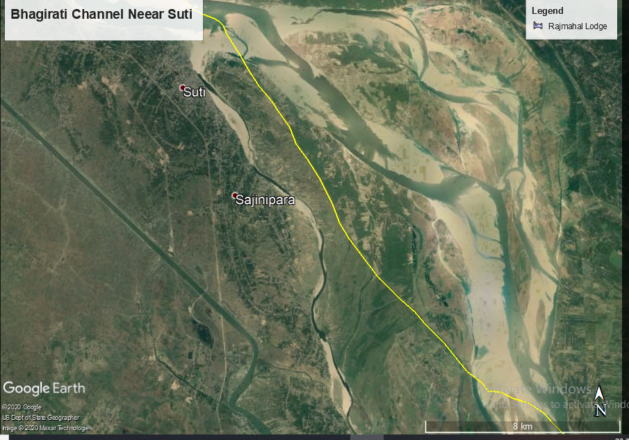
The Indian plate is heavier than the Burma plate and it is subducting along the north-south stretched Arakan- Yoma hills. Since the 12th century, the Bhagirathi-Hooghly is not main distributaries of Ganga. Due to the tectonic event, the Padma is now the main channel as entire Bengal Bain has tilted towards the south-east direction. The Bhagirathi-Hooghly channel is almost disconnected from the main channel it receives water only a few days of Monsoon. Now it is getting water only from the feeder canal of Farakka barrage where the amount of silt is very low.

Majority of the silt is being carried towards the Padma-Meghna system. Moreover, this system receives a huge amount of silts from the Brahmaputra. The tributaries which are originated from Chotanagpur plateau remain the source of silts of Bhagirathi-Hoogly system. It was noticed that the Meghna River (Ganga+ Brahmaputra) carry 166.7 corer ton silt/year towards the Bay of Bengal. Earth scientists have calculated that if this continues for 100 years, the entire continental shelf of Bay of Bengal will be covered up by the silts. The present coastline may reach up to 150 km south at the edge of the shelf despite huge isostatic pressure the silts. But it has not happened over 800 years. Because in every Monsoon (May to October) and months of the cyclone, the silts of Meghna are being carried out towards the west. Finally, they reach ‘Swatch of No Ground’ and from there they travel across the ‘Bengal Fan’ to nourish it.

The deltaic part of West Bengal does not receive the silts of Meghna despite its closest ally. The silts which are brought by the Bhagirathi-Hooghly system mostly deposits both sides of estuaries. The deltaic part of West Bengal is gradually increasing towards the Bay of Bengal despite coast erosion. The satellite images and the depth chart of North Bay of Bengal support this event. However, the rate is faster in the eastern side and slower in western sides. The eastern parts are increasing with the rate of 15 m/year. According to some geologists, the silts of ‘Bengal Fan’ often come towards the Sundarban with sea waves and causes blockages of the inlet or estuaries. The land both sides of the small inlets are joining with each other from the source like zips and deltas are increasing towards the bay.

